

The Scenic Route
What happens when the Scenic Route is obstructed?

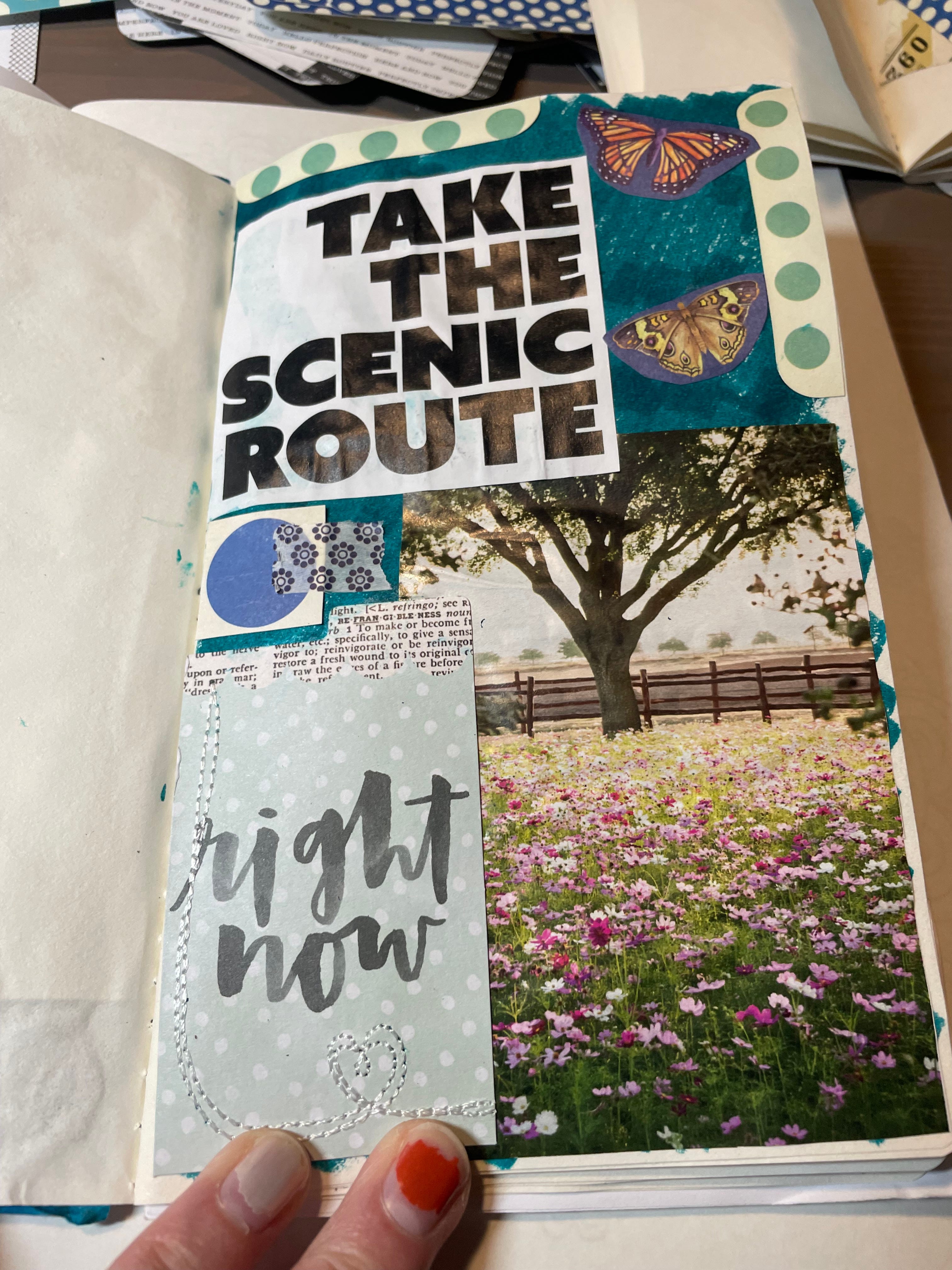
The come down from book writing has finally landed me in a place where I can be creative again. I’m still stuck on completing most writing, however, but have been able to start doing other creative projects to restart my brain. One of those has been junk journaling. I’m one of those people who has a hard time passing up a good journal or sketchbook so I have a small pile that have gone unused over the years and they have found use in the last few weeks for this little project. My years of dedicated scrapbooking in the 2000s left me with an ample stash of papers and ephemera which has come in handy, too. I find limiting myself to a certain amount of supplies prevents overwhelm. This applies to magazines as well. You only need a few, less than 5, to really choose words and associated photos to throw into the collage. So far my favorite magazine has been Magnolia Journal, of which I only have one issue to work from, due to its wide range of font styles throughout and its general positive affirmation tone to pull phrases from. The best place I’ve found to find magazines is my Friends of the Library sale rack at the library, where magazines are 10 cents each. It’s been a great place to find issues of Texas Highways because I don’t necessarily want to cut up my own subscription issues but will certainly cut into a second one I bought for next to nothing.
Taking the Scenic Route is on my mind this week as I’ve been hearing the news coming out about the border wall expansion into the Big Bend region. It’s vomit inducing, like just about anything having to do with this administration. I have only been to Big Bend National Park once, back in the spring of 2000 for Spring Break during college. Six of us drove from Galveston to the National Park in two different vehicles. People had cell phones back then of course, but I don’t know that anyone in the group beyond my husband, then-boyfriend, had one and we certainly didn’t have the foresight to exchange cell phone numbers before we got on I-45 North to head out of town. Our two vehicles stayed together until around I-610 South when the other car exited (to loop around to I-10) and we kept going north through downtown to get on I-10 there. I have a vague recollection of the three of us in Chris’ car (me, Chris, and our friend Rosemarie) shrugging and hoping for the best that we’d just meet up with them at Big Bend.
We drove all day and finally arrived at the park entrance some 12+ hours later to find no sign that the others had arrived. I don’t even recall if we had a reservation or if that was even a thing at that point in time. Given that we didn’t even exchange cell phone numbers, if even the others in the group had one, I’m going with the story that we likely winged the whole situation and were hoping we’d find a campsite once we arrived. Alas, pay phones still existed (no cell signal in Big Bend in those days, I wonder if that’s changed?) so I called my parents to let them know what was going on and then called the dorm room of two of the girls in the other vehicle and left a message on their phone. There happened to be a private campground outside the park that we were able to stay at for the night and the next morning our friends showed up. They’d driven as far as Seguin the first time but turned back to Galveston having worried we’d turned around once we’d split up. Once they got our voicemail they drove through the night to meet us out at the park. Ah, the days of college adventures and poor planning that still managed to work out in some manner!
We spent the rest of the week camping and hiking around the park and even crossed into Mexico the old fashioned away, by paying some Mexicans to ferry us across the Rio Grande. We walked into Boquillas del Carmen with the other American tourists and I can’t recall if we did anything other than walk around and sightsee once we got to the village. This was pre-9/11 so we’re talking minimum to no security. Certainly no passport was needed. None of my photos are digitized and I didn’t feel like scanning any for this essay. Honestly, when I sat down to write this I had no idea how it was going to even come out.
I’ve wanted to return to Big Bend National Park ever since but have not made it happen. Big Bend Ranch State Park has been higher on my list to visit than the National Park but our forays into west Texas in the last decade have always taken us to the Davis Mountains and we enjoy that area so much we haven’t expanded beyond there.
“A prevailing notion across the land was now that industry and industry allies carefully placed at the regulatory agencies should take pride in getting away with it. There seemed to be a schoolyard belief that because one side of the political divide has made it a point to protect the land and water of the commons, the other side ought to make it a point to exploit, abuse, and even despise the commons. And the glee over their many “victories” was repulsive to me.” - Jay Erskine Leutze in Stand Up That Mountain
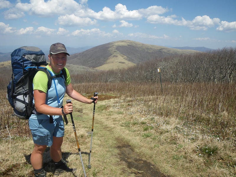
The Appalachian Trail is a National Scenic Trail, primarily administered by the National Park Service in conjunction with a plethora of other federal, state, and local agencies where the footpath crosses. At approximately 2,200 miles long, its protected width varies depending upon the public land it is passing through at any given time. In some areas, particularly in Virginia and the mid-Atlantic states, the trail may be confined to narrow mountain ridges where viewpoints extend down into valleys below where hikers generally get extensive glimpses of farmland or small towns nearby. The AT is crossed by transmission lines and pipelines as well as roads throughout its corridor.
After the many decades long effort to secure a permanent and protected trail corridor, the Appalachian Trail Conservancy has been focusing on the trail’s viewshed which is just as important as protecting the footpath itself. Who wants to come to a view along their hike to see a massive mining operation or trash dump instead of miles of pastoral or mountain scenes? No one.
Published in 2012, Stand Up That Mountain by Jay Erskine Leutze chronicles the fight to stop a gravel mine from destroying a mountain near the Roan Highlands in western North Carolina. Not only was this mine going to affect the quality of life and health of locals but it was going to severely impact the viewshed of the Appalachian Trail. The views and trail itself of the AT are already impacted in some areas, the most notable being the area around Palmerton, PA in the Lehigh Gap where decades of industrial zinc smelting led to the impacted areas being declared a Superfund Site. The trail traverses this area and while the pollution impacts are slowly being mitigated, it will take centuries for the environment to be healed here.
Viewsheds aren’t just important to trails. It’s why we have NIMBYism for all sorts of projects around the country. No one wants massive condos being built in what were formerly early to mid-century residential streets in urban areas. It impacts lighting and shades out neighboring homes and often destroys older growth trees. Who wants a new power plant built half a mile from their home? No one.
Protecting the scenic view of areas is so important we have the Dark Sky program because we’ve deemed seeing stars at night is of greater importance than lighting up the landscape to see during a period of time we weren’t meant to have light. Even the Bureau of Land Management has a Visual Resource Management component to their agency.
So, why are we building a border wall through some of the most scenic and remote areas of the U.S./Mexico border? (To be clear, I hate the wall as a whole as you’ll see below. In my daydreams where I become the first woman President, the first thing I do is my own version of “tear down this wall.” Alas…)
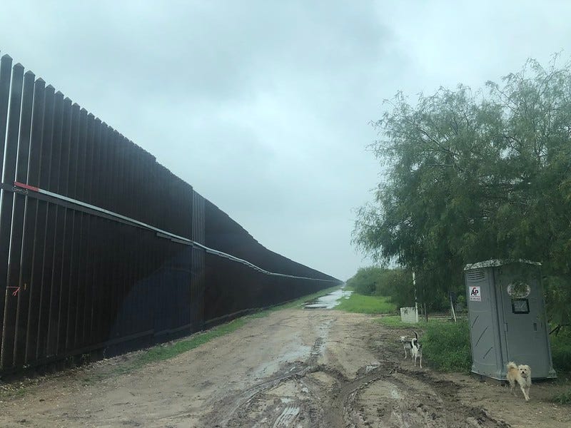
I don’t really spend any time around the Texas border. I would like to visit more often as there are several refuges and parks along the area that are home to some unique plants and animals, particularly migratory bird and lepidopteran species that come into the area from south and central America. In 2022 I saw the border wall/fence for the first time. It’s ugly. Let me rephrase that: It’s ugly AF. And of course it doesn’t follow the actual border of the U.S. and Mexico because that border in Texas is the Rio Grande and the river isn’t straight; therefore, the wall is placed quite a bit inside the U.S. and you have to go through the wall in some areas if you want to access the area behind it, which is still the United States.
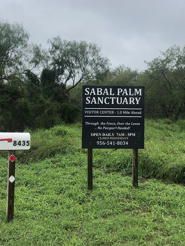
Sabal Palm Sanctuary is located southeast of Brownsville and Matamoros along the river. We had to pass through the wall to get to the sanctuary and the little sign in the photo above really has to reassure visitors that indeed you are in the right place despite the Big Scary Wall and your phone dinging to tell you, “Welcome to Mexico. These rates may apply to your plan.” But I’m not in Mexico!
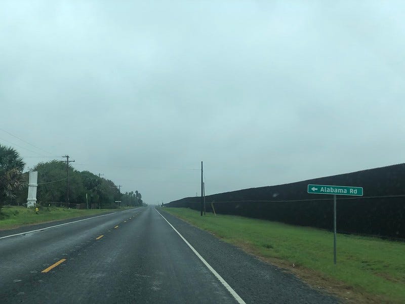
As you can see, the wall is ugly and intrusive, even in the most benign and not-so-scenic-to-most-people locations outside of Brownsville. It is miles of tall metal fencing that obstructs the viewshed and disrupts the migratory pathway of wildlife. The viewshed here may be a patchwork of farm fields, rural homes, or natural areas, certainly perhaps nothing that might compare to the distinct desert landscapes of the Big Bend region—but it’s also not nothing. The viewshed here matters, too.
But take all of this I’ve shown you above and imagine it in Santa Elena Canyon. Or Big Bend Ranch State Park.
If those places aren’t sacred, then nothing is.
And we’ve seen enough from this federal administration and its previous incarnation that public lands in general are not sacred to any of them.
I’m not sure at this point in time protesting does much of anything. I’ve written to state and federal representatives time and time again, only to get nowhere. I have no faith in my own Texas legislators to do anything because they are bootlickers to this administration. That said, I still email to at least have my opinion on record.
I suggest you do the same.
In Texas I like to use this link: Who Represents Me? for easy access to all of my legislators. Even if you aren’t in Texas, please reach out to your representatives because Big Bend National Park is federally managed and is visited by people throughout the country and world. Your opinion matters.
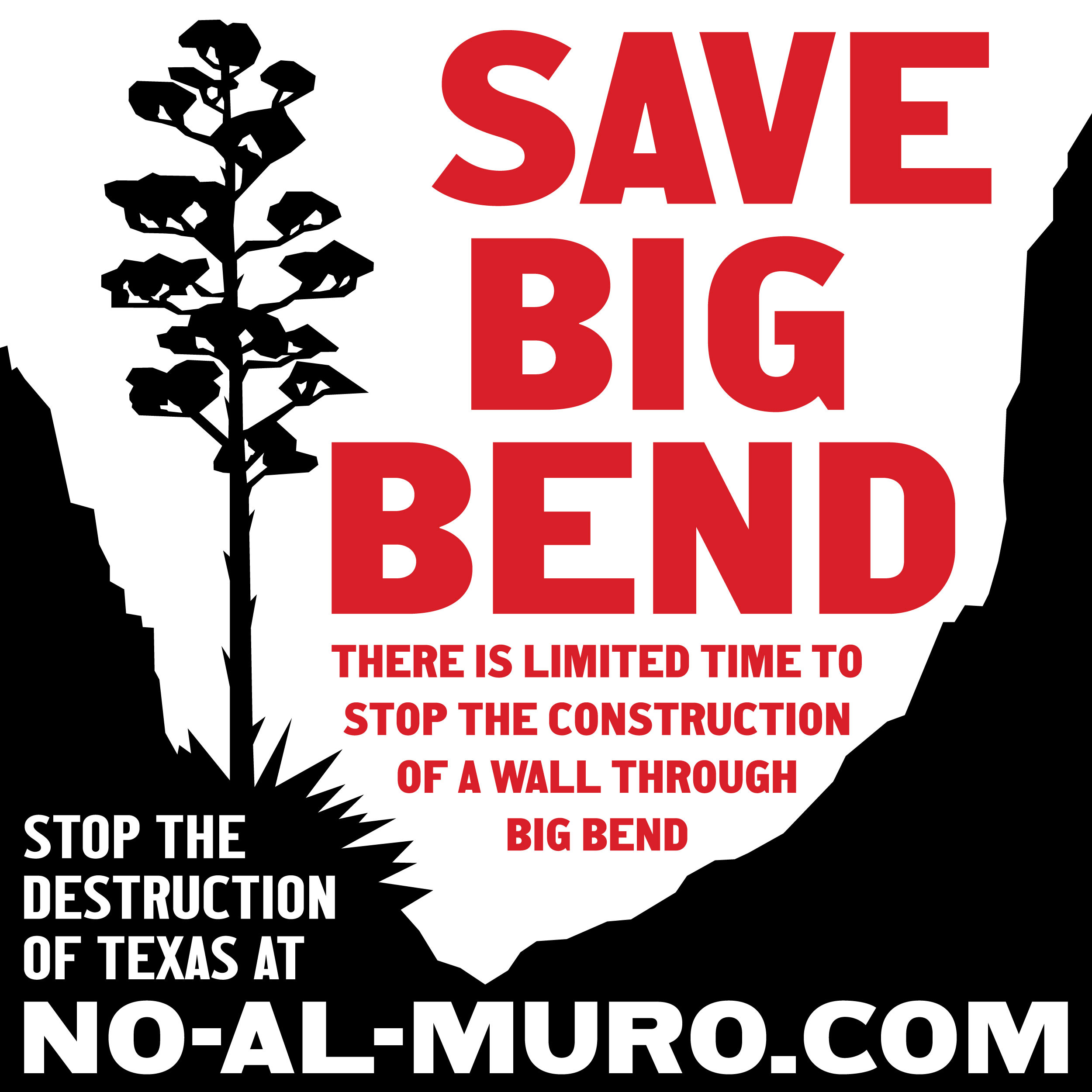
More information and to get involved at No-Al-Muro.com.
Watch: The River and the Wall documentary.
Misti, this is a great essay, celebrating the Scenic Route and The Road Not Taken. For now at least, the people who take perverse pleasure in exploiting and despoiling the most beautiful, untouched areas in America are on the rise — and "getting away with it."
What is happening in the Big Bend right now may be the most dramatic example of this sadism — proposing to build a wall through the national and state parks that will be a huge waste of money and permanently sabotage the economy of the whole Trans-Pecos region.