A Journey to the Extremes of the Texas Coastline
This year I managed to visit the extreme points of the northern and (almost) southern locations along the Texas coast. This is how they compared...
Texas Point National Wildlife Refuge at Sabine Pass
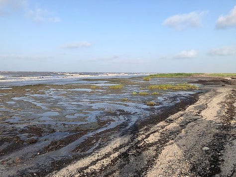
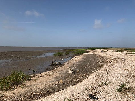
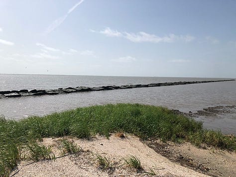
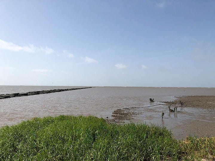
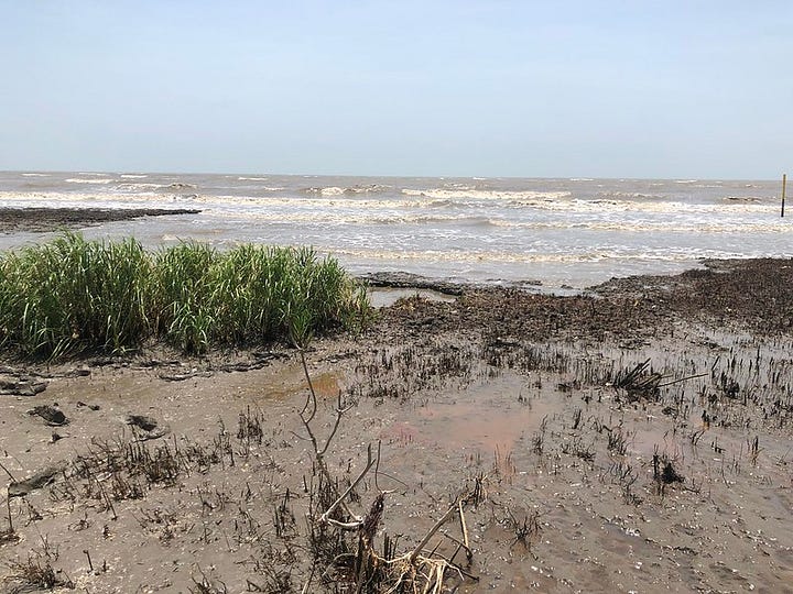
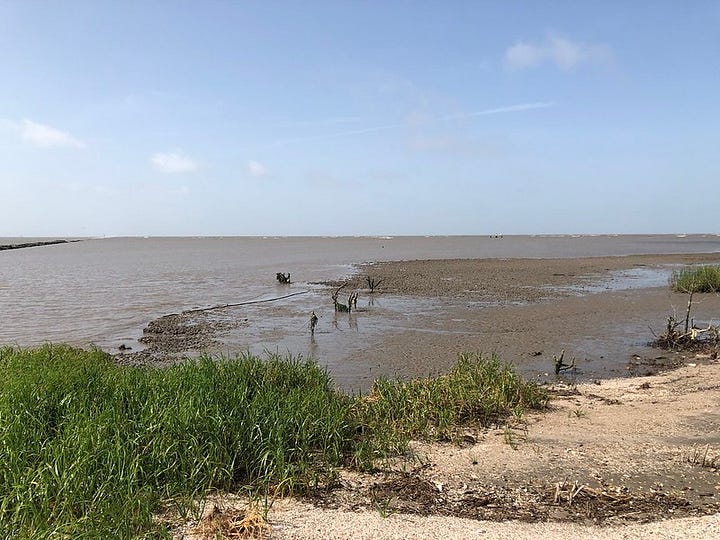
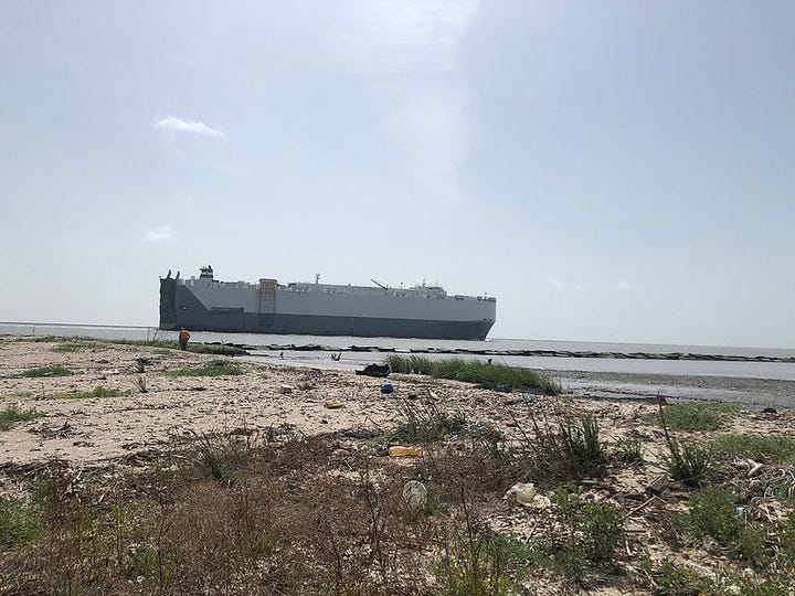
The first time I was at Sabine Pass I was in a small john boat the summer of 2000. It was the summer between my sophomore and junior years of college and I was attending Texas A&M at Galveston. I’d signed up for a sea turtle tagging internship to get some credit hours and boost my resume. The internship took us to Sabine Pass as well as Calcasieu and Mermentau Passes in Louisiana. Our goal was primarily to capture, tag, and release any endangered Kemp’s ridley sea turtles we found, but also any other sea turtles we happened to catch that summer.
And then 22 years passed and I found myself participating in a wetland delineation along the beach shoreline at Texas Point National Wildlife Refuge. I don’t get out and do much field work these days but I savor it when I’m able to join. This area of the coastline is really only accessible to people coming by boat or via a private entrance adjacent to the refuge. Or, I suppose you could walk the entire beach from a public access point at Sea Rim State Park further west, but that would be an intrepid person who did that. We utilized ORVs and there were some sketchy areas where channels were cut along the beach that I wasn’t sure we were going to make.
The Upper Texas Coast is a highly eroding system. According to the Texas General Land Office, about 64% of the entire Texas coastline is eroding at about 6’ per year, and it is without a doubt higher than this on the Upper Texas Coast. You can get a small grasp on the erosion in the Upper Texas Coast by seeing how close Highway 87 near High Island is to the Gulf of Mexico. Highway 87 used to traverse the coastline all the way to town of Sabine Pass but the section from High Island to Sea Rim State Park closed permanently in 1990 because it ended up in the ocean.
Beach renourishment projects abound along the Texas coastline and elsewhere in the US. Most of the time they take place along areas they are developed in order to protect and preserve the buildings built up along the shoreline. On the Upper Texas Coast a lot of the projects go towards protecting the wetlands behind the beaches, as there are several national wildlife refuges in this area and important migratory bird habitat in this region. I could get into more nitty gritty details here but that’s not the point of this post. The point is, this area is highly erodible. I make maps for my day job and I can easily look at historic aerial imagery (or you can pull it up yourself on Google Earth) and compare how much shoreline has been lost over the last 60 years. Historic topographic maps will show the coastline hundreds of feet further into the ocean than it is currently. Beaches and wetlands have been eaten away by the Gulf’s dynamic wave action. This isn’t an anomaly, you can see this happening into coastal Louisiana, too.
If you look at the photos above you’ll see what looks like vegetation in the intertidal zone—and it is. That was a wetland a year or two ago. Now it’s the beach/ocean interface. There will be ocean, remnant wetland, beach, wetland. No dunes. Sometimes the wetlands just bleed into the ocean here.
Of course, there’s trash. Plenty of trash. Hard hats from offshore rigs, random baskets, bits of plastic, always plastic. In between all of that, life still keeps going. Animals wash up, alive or dead, shorebirds forage and nest. Crabs scurry along, looking for their next meal.
And next year more wetlands will erode or a hurricane will come in and accelerate the speed of loss. The looming specter of climate change and sea level rise will continue to influence the loss of beaches and wetlands here in the coming decades, too.
Boca Chica Beach Approximately 3 Miles from the Rio Grande
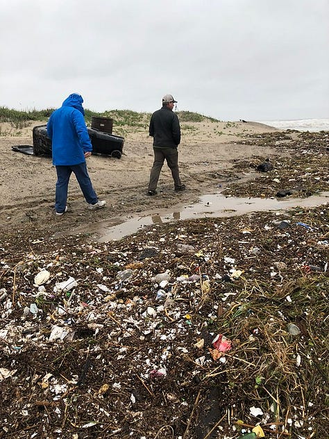
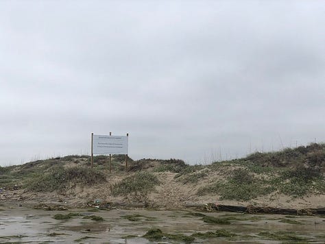
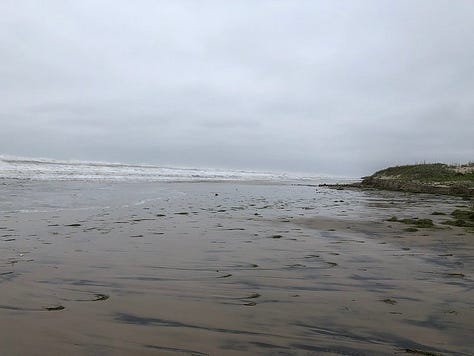
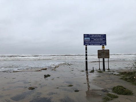
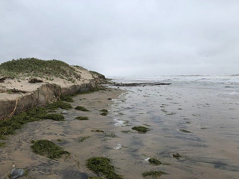

The southern most beach in Texas is one I have only recent visited. This past Thanksgiving, in fact. Boca Chica Beach is reached via Tx-4, coming from the west out of Brownsville. On a map it is a stone’s throw from South Padre Island but a channel between Brazos Island and SPI separates the beach. By boat, this would be a simple place to explore away from the hubbub of SPI.
Technically it is another 3 miles from Boca Chica Beach to the very end of Texas at the Rio Grande and on this particular day, as seen in the photos, the waves and tide were up and there was not going to be any walking or driving down that beach. At low tide and with 4-wheel drive, that area is accessible by vehicle, as evidenced by aerial imagery on Google Earth. Texas Bob has a great write-up and photos to show the ease of access from both the Texas and Mexican sides of the river during favorable conditions.
Erosion in this area of the Texas coast is lower from what I can tell on aerial imagery, but still occurs. We came down to the beach during very bad weather. A heavy cold front had blown in and there were gale warnings the day we arrived on SPI. Getting across the Queen Isabella Causeway from Port Isabel to SPI was rough. The seas were very choppy. My brother and his family, who had been to SPI several times before, were dismayed to see how much the beach had eroded since the last time they had visited only a year before. Whether it was due to this particular storm or from other events in the meantime, I don’t know. I do know that the waves were lapping at the base of the dunes at both SPI and Boca Chica Beach.
Speaking of dunes, I mentioned there were not dunes at Texas Point. It’s pretty uncommon to see dunes on the far Upper Texas Coast—they entered the Gulf of Mexico decades ago. There are some faux dunes in Galveston from previous beach renourishment projects, but they are very small in comparison to natural dunes elsewhere. Starting somewhere around Surfside Beach near Freeport and going south, the dunes pick up sporadically. Matagorda Island has decent dunes in many areas and Mustang Island around Port Aransas also had a hefty set of dunes in many areas, though I’m unsure what they look like post-Hurricane Harvey.
While I didn’t get to glimpse the beaches here very well, you can tell erosion is definitely an issue and Tx-4 in particular will be underwater in the coming decades unless a long or intermittent bridge is built. With Space X’s Starbase existing in these hinterlands, I can’t see that money wouldn’t be spent for some kind of upkeep in the future. I noticed on my Apple Maps the day we arrived, the one with the gale force winds, that the road was closed because water was covering the road. The bay/wetland/road interface was all one item that day and two days later when we came through road crews were working to repair the eroded road bed. I imagine this isn’t the only time throughout the year this needs to be done. You can see a glimpse of part of the Starbase in one of those photos above. It really is something you can drive up to, and have to drive by in order to reach Boca Chica Beach. It’s truly bizarre.
The link here to Texas Point is of course the pollution. Plastic littered the access point from the storm/high tide and you couldn’t help but jump over piles of intermingled aquatic vegetation, plastic bits, and old chunks of wood. It is truly disheartening. I wish I had the answer for how to solve this global catastrophe but it would likely require a time machine to the 1940s and rewind the widespread introduction of plastics into our life.
Where to go from here?
As I started writing this I realized this was probably something worth investigating in more detail with future newsletters. Covering the differences in habitat, erosion, and pollution as well as highlighting the entire coastline overall is something of interest that I think I will explore a bit further in the coming year. With 367 miles of coastline, there’s plenty to delve into deeper. So, stay tuned for more in 2023!
Thank you all for reading these last few months as I’ve started this newsletter! I primarily write at Oceanic Wilderness and am on Instagram as @oceanicwilderness . I also produce two podcasts Orange Blaze: A Florida Trail Podcast and The Garden Path Podcast. I juggle a lot but I enjoy doing it all! See y’all next year!
Further Reading


Great stuff, Misti! Thanks so much for sharing.